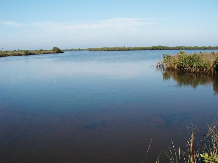
LOCATION: (lat. 28°00'00.0" N., long. 82°00'00.0" W.)
Hudson, West of Old Dixie Hwy, in the marsh behind the active Sunwest Mine. Access is by boat.
DESCRIPTION:
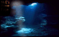
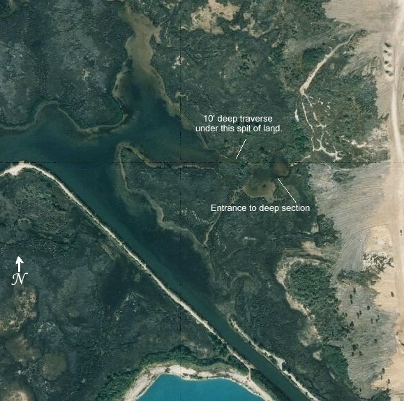
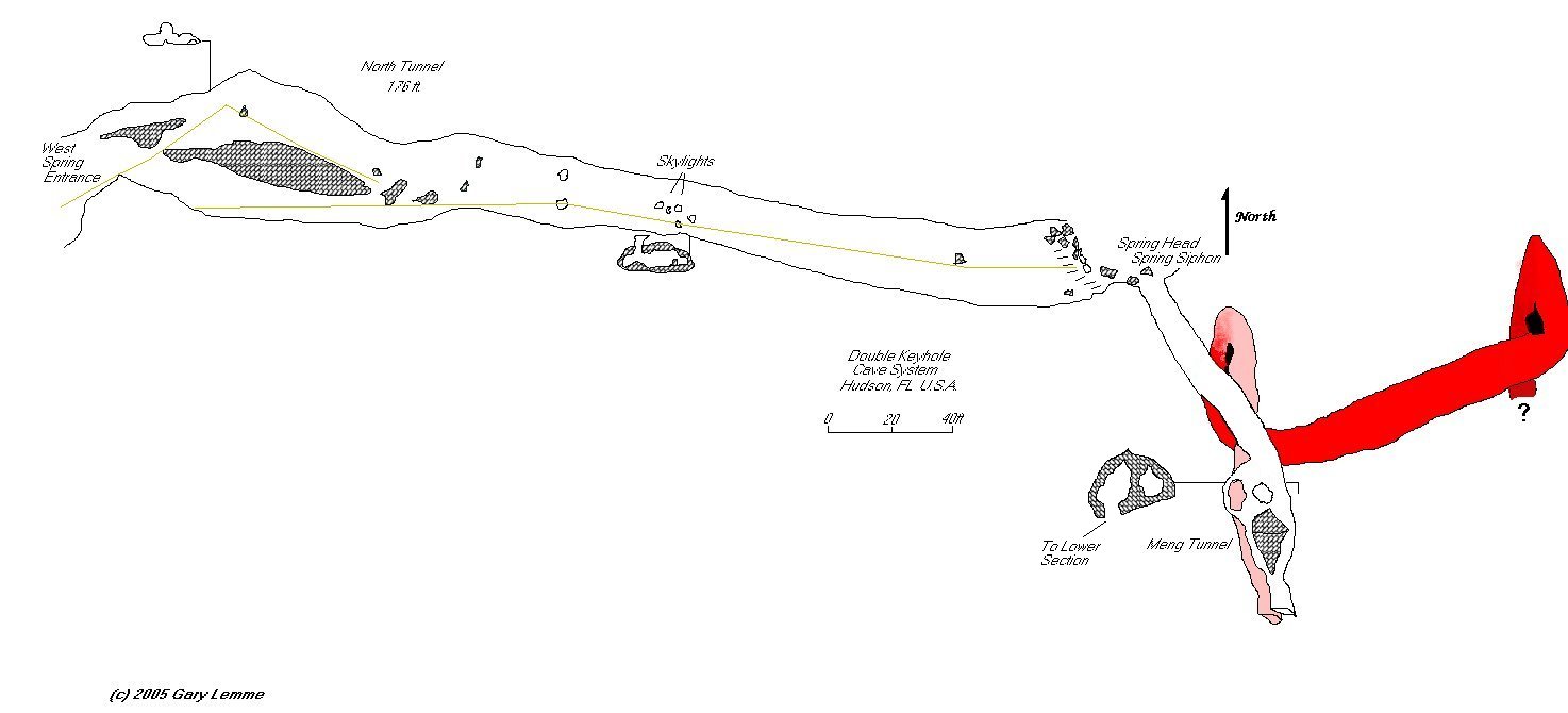
Double Keyhole is a deep cave that funnels thousands (millions??) of gallons of water each day through a system of interconnected vents and shallow passages which eventually empty into Fillmans Bayou. The main "spring" entrance to the bayou is under a large rock outcropping at the Eastern edge of the bay. A shallow traverse with an average depth of 10ft leads to a small basin with two flowing vents, the larger one in the Northern end is the main source of flow and the start of the main line into the system. The two vents are also connected by a shallow traverse that runs above the main cave passage. There is a solution tube in the floor providing a "shortcut" directly down into the ceiling of the main cave passage, the traverse gets tight between the "shortcut" and the larger vent. One can access the main cave passage directly from the large vent but it is easier to pop in the small one and take the "shortcut". The vis fluctuates but it's usually 20' or less, depths of over 300ft have been reported.
DIVELOG:
Arriving by boat, we set anchor in front of a submerged
outcropping of limerock. The water was clear and we could see bottom once
out of the channel and into the springs run (watch out for rocks). It was
just shallow enough to get geared up along side the boat and though we
kicked up a lot of sediment, it was quickly dispersed. After a gear
check, we ducked under the ledge and followed the sloping bottom down to
the opening where we were immediately confronted with a line heading in
two directions. The first traverse is actually a circuit ( with plenty
-o- side passages), one can go either right or left and still get to the
basin where the two springing vents are located. For reasons unknown, I
tend to head left when confronted with these situations, I did and enjoyed
poking around the shallow traverse, eventually meeting up in the sunlight
of the basin with the others as they emerged from the right hand passage.
Without surfacing we made our way to the closest vent, headed towards the
main vent and dropped down the "shortcut", a jump in the line down a solution
tube that put us directly on the main line. The flow was quite strong and
the water was clear, though it had many suspended particles that caused
a lot of back scatter from our lights and reduced overall visibility. Heading
deeper into the system we came to a bend where many small nodules of rock
that have been bounced around by the flow and rounded smooth have been
trapped, some call this the "coffee bean" room. The passage continued down
in a switchback fashion until we got to a point where it pretty much headed
straight down. The visibility seemed to get worse just about the time we
found the broken end of the line flapping in the powerful flow. Since the
depth was now over 200' and it had become a "grope dive", we called
it and headed for the surface.
Instead of taking the "shortcut" we decided
to follow the main line all the way out and had an enjoyable deco exploring
the numerous nooks and crannies of the traverses back to the boat. Once
out of my gear, I waded ashore and explored the area over the circuit.
The surface is a swiss cheese of numerous small pools fed by the
spring, all seemed to be teeming with life.
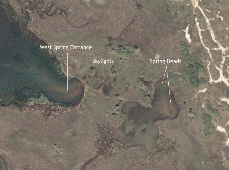
![]() A Higher Aerial View of Double Heyhole
A Higher Aerial View of Double Heyhole
![]() Map of Double Keyhole by Gary Lemme (transposed to digital image as best I could)
Map of Double Keyhole by Gary Lemme (transposed to digital image as best I could)
